
Hiking 132 miles through New Mexico on the Santa Fe to Taos Trail
The Santa Fe to Taos Trail: A 132-Mile Thru-Hike Through New Mexico's Sangre de Cristo Mountains
I wrote a full guide to this trail for The Trek — you can read the original article here: https://thetrek.co/santa-fe-to-taos-trail-132-miles-through-new-mexicos-sangre-de-cristo-mountains/. This is my own take on it, with everything you need to plan your own SF2T adventure.
Before this trip, New Mexico wasn't on my radar. But the Santa Fe to Taos Trail completely won me over. It's an excellent route that hasn't been overrun yet: no permit lottery, no queues at the trailhead, just 132 miles of mountains, lakes, and open sky between two towns that are genuinely worth visiting.
The SF2T links Santa Fe Plaza to Taos Plaza right across the backbone of the Sangre de Cristo Mountains, passing alpine lakes, river valleys, and high passes above 12,000 feet. Wild camping, abundant water, and a cultural payoff at both ends — it's a really well-rounded adventure.
THE BASICS
Distance: 132 miles (212 km)
Time: 7–14 days (roughly 10–20 miles/day)
Location: Northern New Mexico — four counties, three public lands (Santa Fe NF, Pecos Wilderness, Carson NF)
Best Season: Mid-June through early October; August–September is peak
Trail Type: Point-to-point thru-hike
Return: NCRTD "Blue Bus" shuttle between Taos and Santa Fe
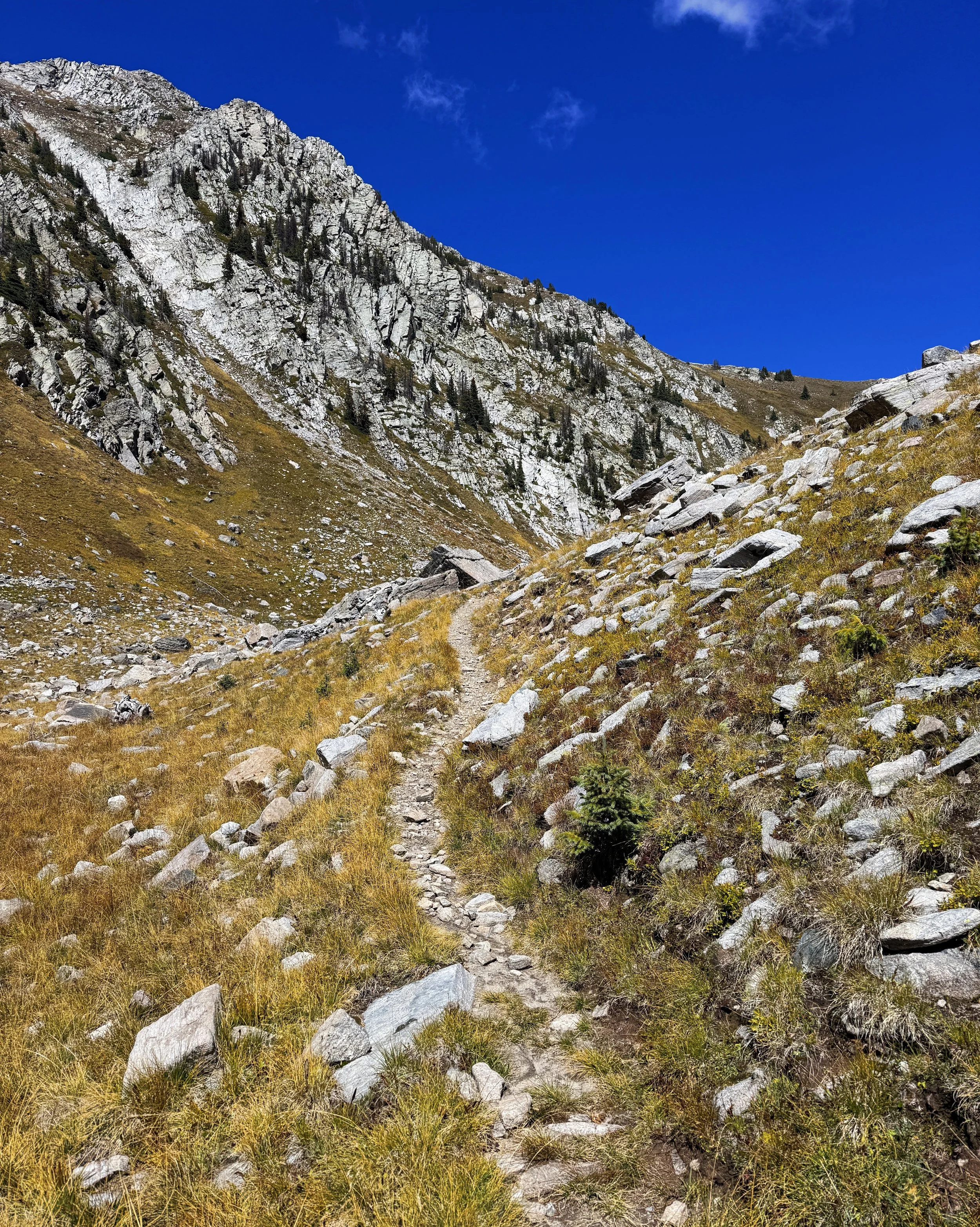
Terrain: Moderate to strenuous; expect 2,000–4,500 ft of daily gain/loss at elevation
Navigation: GPX files and guidebook available — trail isn't signed for this route specifically
GETTING THERE
Fly into Albuquerque (ABQ) and hop on the Groome Transportation Shuttle to downtown Santa Fe — it's about 75 minutes and runs regularly throughout the day. You can book ahead online or call 505-474-5696. At the airport, find the pickup area past Carousel 8 in baggage claim.
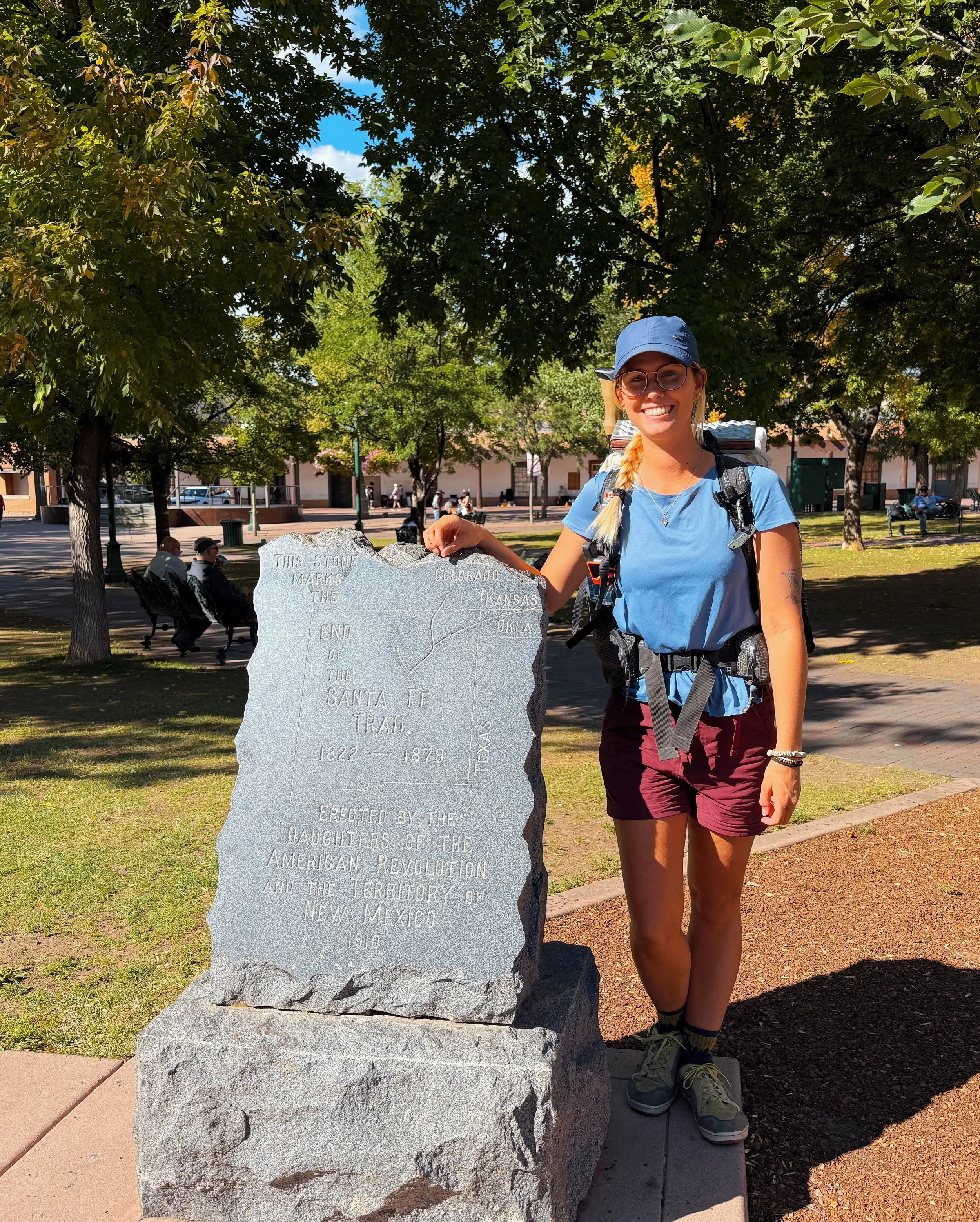
The trail starts at the granite Old Santa Fe Trail marker on the southeast corner of Santa Fe Plaza (7,000 ft / 35.6876°N, -105.9389°W) and finishes at Taos Plaza (6,970 ft / 36.4074°N, -105.5730°W). The elevation at both ends is nearly identical, which is a satisfying geographical coincidence.
WHICH DIRECTION?
Go northbound. Starting in Santa Fe and finishing in Taos lets you warm up in cooler forest terrain and build your legs before hitting the big alpine passes. Southbound works logistically, but it throws you into a steep climb out of Taos right on day one — which is a rude welcome.
WHY THIS TRAIL?
The SF2T doesn't need much selling. It's a wilderness route connecting two UNESCO Creative Cities, meaning you get proper backcountry isolation — elk, star-filled skies, Pecos Wilderness ridgelines — bookended by good coffee and great food in towns that are genuinely interesting places to spend time.
There are no permits. No quotas. Water every 3–4 miles for most of the route. And it fits comfortably into two weeks, which makes it one of the most accessible long trails in the American West for people who can't take a month off work.
If you want something that feels wild without requiring six months of planning, this is it.
WEATHER & CLIMATE
The trail sits between 7,000 and 12,000 feet, so be ready for the full range. Days are warm and sunny — usually 65–75°F (18–24°C) — but nights can dip near freezing even in August. The Sangre de Cristos get 280 sunny days a year, but monsoon season (mid-July through early September) brings reliable afternoon thunderstorms. Get your miles in the morning, and be off exposed ridges by early afternoon.
Snow can linger on north-facing slopes into June, and fire restrictions are common in May and June. Above treeline, hail and high winds can appear fast with very little warning.
GEAR NOTES
You're hiking at altitude in a place with strong sun, cold nights, and afternoon storms. Plan accordingly. Read my full clothing guide here.
Sun protection: UPF shirt, sun hat, high-SPF sunscreen — the altitude makes UV exposure serious.
Rain shell: For the near-daily afternoon showers during monsoon season.
Sleep system: A 20–30°F bag and a sleeping pad rated R-2 or higher.
Trekking poles: Useful on the loose and rocky high passes.
Water filter and electrolytes: Both matter at elevation in the heat.
Food storage: Lightweight bear canister or hang system — follow local regulations.
CAMPING
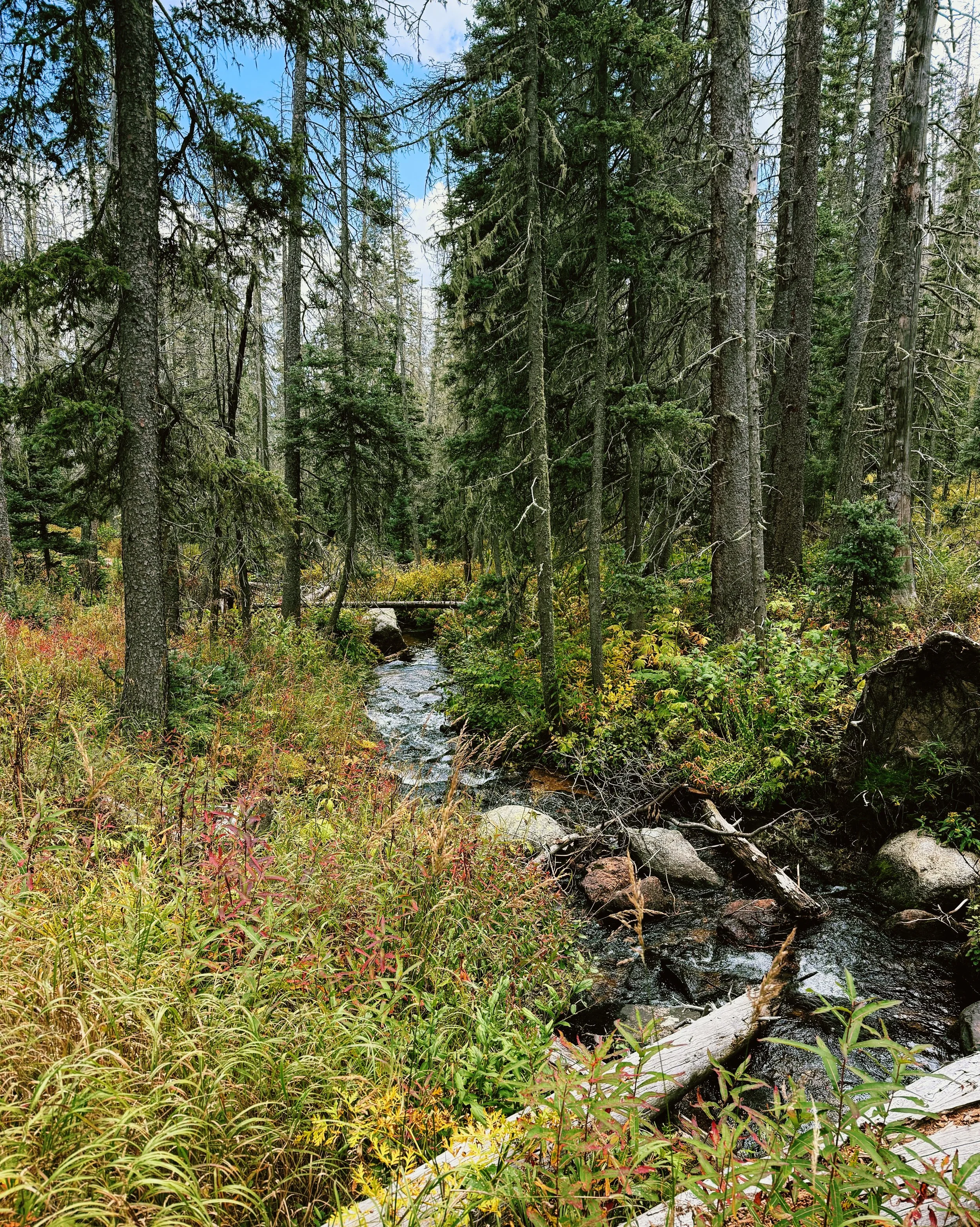
Dispersed camping is open throughout the Santa Fe and Carson National Forests (except where posted), and no permits are required for backcountry camping. Developed campgrounds close to the route include Aspen Basin, Panchuela, Santa Barbara, and Agua Piedra. You'll find beautiful spots near rivers and meadows throughout — just practice Leave No Trace.
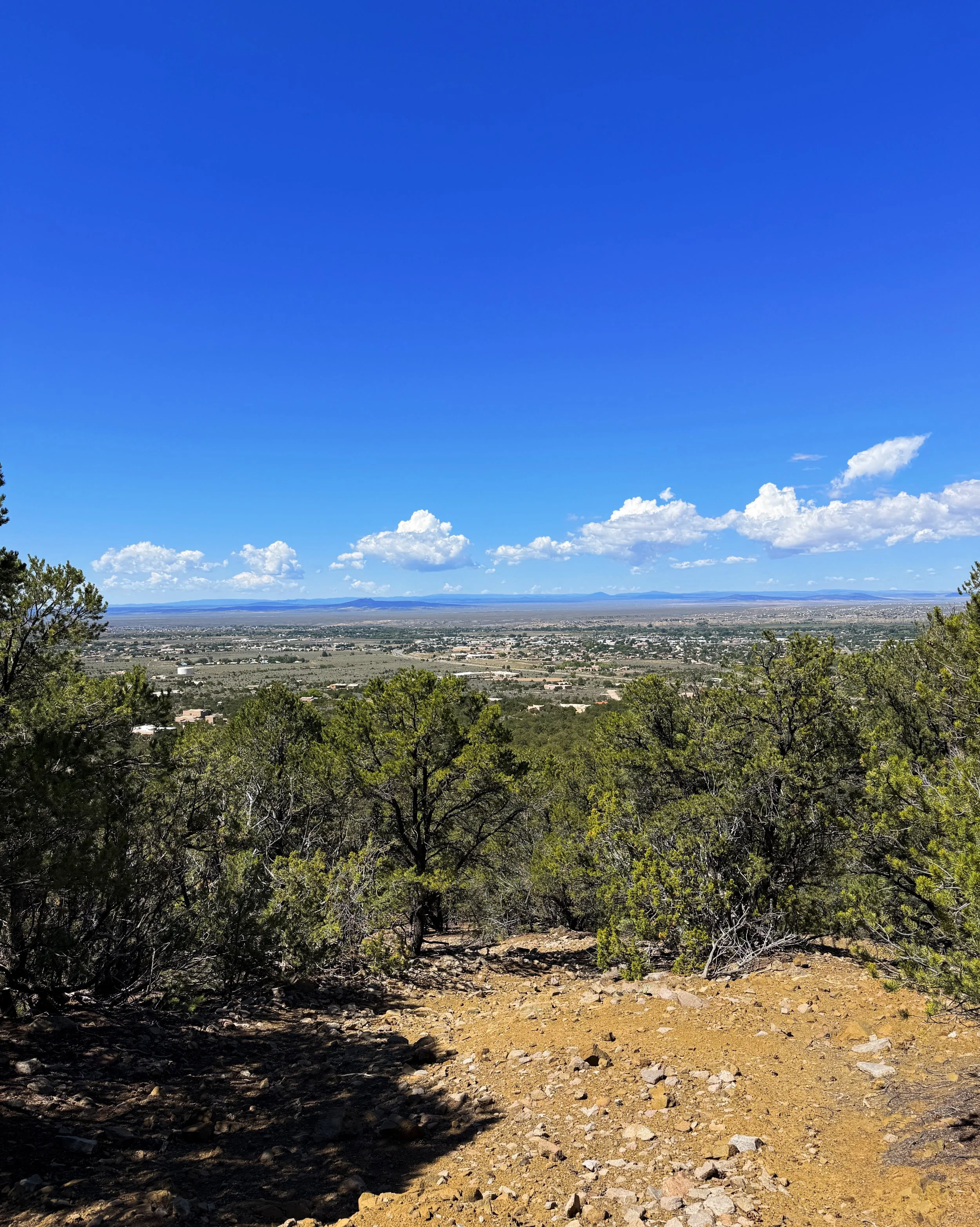
HIGHLIGHTS
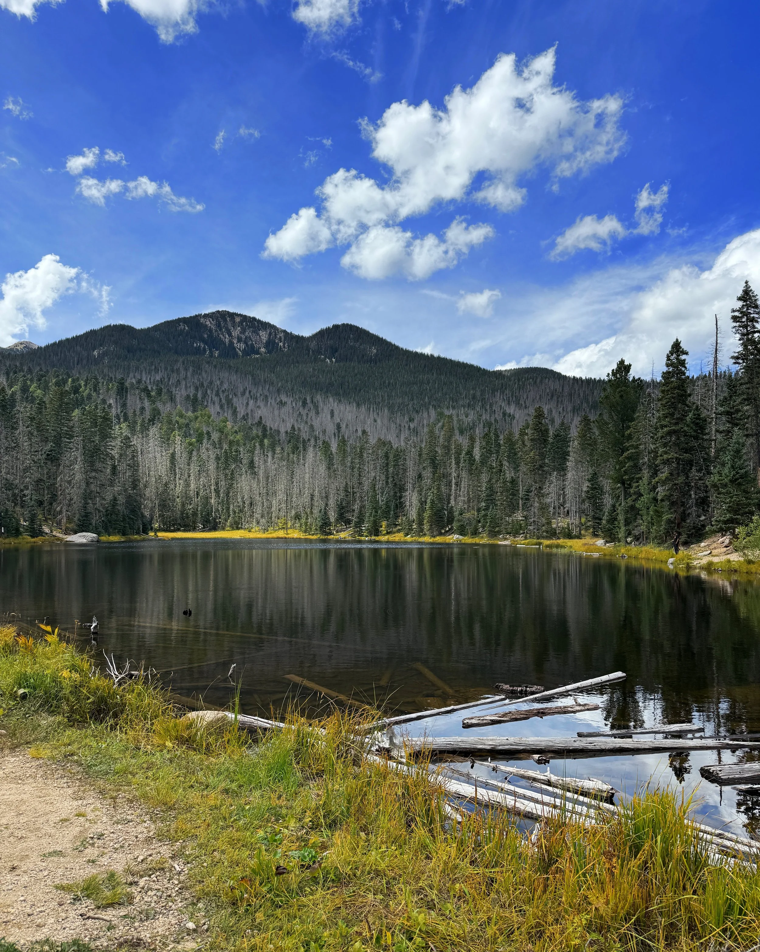
Lake Katherine (11,742 ft) is the showpiece — a clear alpine lake sitting right below Santa Fe Baldy. It's the kind of spot that makes you stop walking just to stare.
Pecos Baldy Lake and the Truchas Peaks give you high-alpine basins and a close look at New Mexico's second-highest summit. Santa Barbara Divide opens up sweeping Pecos Wilderness panoramas that feel enormous. The Agua Piedra and Tres Ritos valleys are quieter and shadier — all aspen and pine, a nice change of pace after the exposed ridges.
And then there's the finish: walking straight into Taos Plaza for a meal and a coffee you've actually earned.
WATER
This trail is well-watered compared to most routes in the Southwest. You'll pass nine lakes — Katherine, Stewart, Pecos Baldy, Truchas, No Fish, Los Esteros, La Cueva, Bernardin, and Stewart Pond — plus countless creeks. For most of the route, you'll find water every 3–4 miles.
The two sections where you need to plan ahead: roughly 9 miles without reliable water between the Ojitos Maes Trail and Rio Grande del Rancho / FR439, and roughly 10–11.6 miles between FR437 / Drake Canyon and El Nogal or Taos Cow.
Carry 1–3L depending on temperature and how warm the day is. And filter everything, however clear it looks.
RESUPPLY
The Tres Ritos Resupply Locker sits just past the midpoint, near Agua Piedra Campground at the entrance to La Cueva Canyon. It's available to members of the Santa Fe to Taos Thru-Hike Association ($100/year). You can mail a box to Pam, and she'll have it waiting in the locker. There's also power banks, cold drinks, and chairs to sit in, which feels absolutely luxurious on day four.
Sipapu Ski & Summer Resort (Vadito, NM) is 2.3 miles off-trail via NM-518 and accepts mail drops at: 5224 NM-518, Vadito, NM 87579 (575-587-2240).
NAVIGATION & TRAIL CONDITIONS
The trail isn't officially signed as the SF2T, but with the GPX file loaded, navigation is simple and intuitive. Overall it's well-maintained and easy to follow. There are some old Forest Service roads and a few unmaintained stretches, and sections of the Skyline, Indian Creek, and Middle Fork Trails can have deadfall or overgrowth after storms.
The route is broken into six sections of 18–26 miles each, which makes it easy to plan as a full thru-hike or break into weekend segments. Detailed itineraries are in the official guidebook.
THE SANTA FE TO TAOS THRU-HIKE ASSOCIATION
The whole trail exists because of Pam Neely and the Santa Fe to Taos Thru-Hike Association — they maintain the route, publish the guidebook and GPX files, and run the Tres Ritos resupply. Membership funds all of that and gets you access to the mid-trail resupply locker. If you're hiking this, joining is worth it. You can find everything — maps, GPX downloads, and membership — at SantaFeToTaos.org.
FINAL THOUGHTS
The SF2T is the kind of trail that should be more famous than it is — and probably will be, soon. It's challenging without being punishing, wild without being logistically complicated, and it ends in a town where you can sit at a good restaurant and feel smug about what you just did. With the water situation, the easy return transit, and the cultural draw of both Santa Fe and Taos, it's one of the most complete thru-hiking packages I've come across that you can complete in two weeks.
New Mexico surprised me. I think it'll surprise you too.